China Geography: Landforms, Cities & Economic Regions
China geography includes mountains, plateaus, basins, plains, river systems, and natural resources. These features shape its climate, population, transport networks, and economic development.
China is also one of the largest countries in East Asia.
The North China Plain, Yangtze River Delta, and Pearl River Delta help explain the location of China’s major cities and industries.
What Are the Main Geographic Features of China?
China has plains, plateaus, hills, basins, and mountain ranges. Mountains cover about 33% of the country, followed by plateaus at 26%, basins at 19%, plains at 12%, and hills at 10%.
China Geography: A Tapestry of Natural Beauty and Diversity
China has mountains, plateaus, basins, plains, and hills. These landforms affect rivers, agriculture, population, and economic development.

Mountains make up about 33% of the land, followed by plateaus at 26%, basins at 19%, plains at 12%, and hills at 10%.
China Geography: High in the West, Low in the East, and Terrace-like Distribution
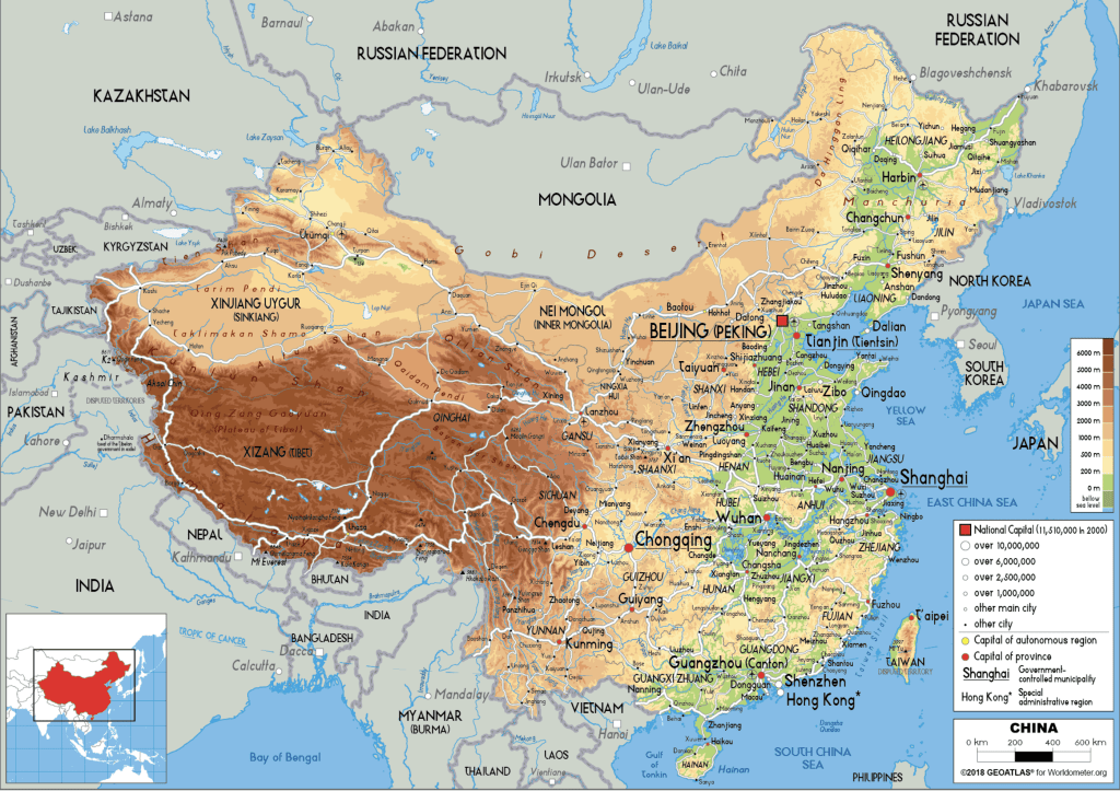
China’s terrain becomes lower from west to east and is commonly divided into three broad terraces:
- First terrace: The Qinghai-Tibet Plateau, with an average elevation above 4,000 meters.
- Second terrace: Plateaus and basins between about 1,000 and 2,000 meters. Major boundaries include the Greater Khingan Range, Taihang Mountains, Wushan Mountains, and Yunnan-Guizhou Plateau.
- Third terrace: Eastern hills and plains, generally below 500 meters above sea level.
Main Landforms of China

- Four Major Basins: Tarim Basin, Junggar Basin, Qaidam Basin, and Sichuan Basin.
- Three Major Plains: Northeast Plain, North China Plain, and Middle and Lower Yangtze Plain. These areas contain important farmland.
- Three Major Hills: Liaodong Hills, Shandong Hills, and Southeastern Hills.
- Mountain Ranges: China’s major mountain ranges include Tianshan-Yinshan, Kunlun-Qinling, and Nanling.
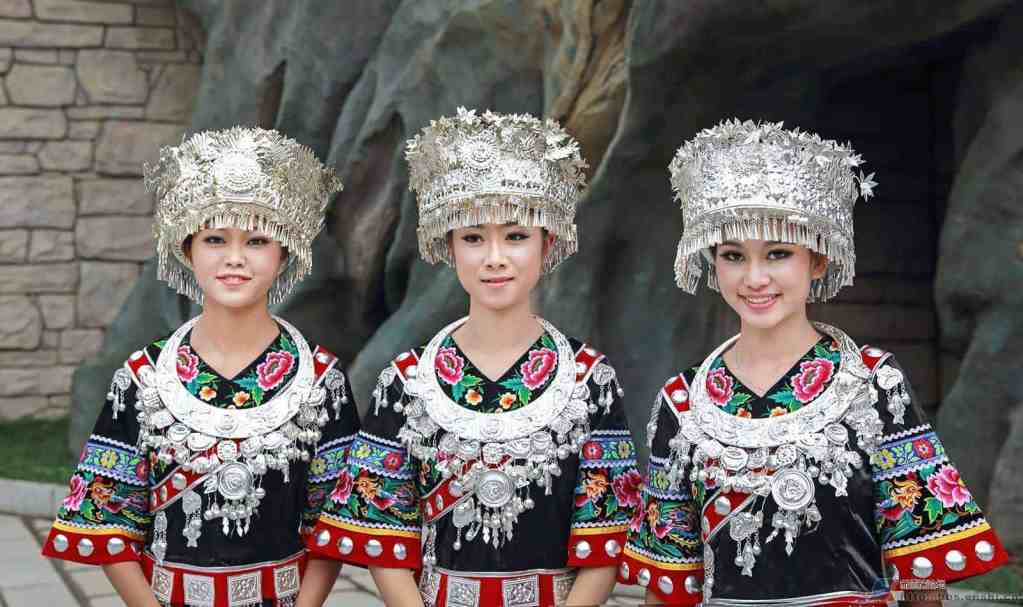

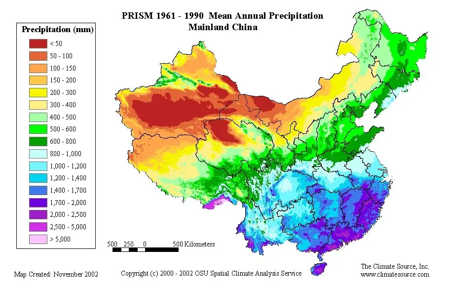
The Impact of China’s Terrain on Climate and Hydrology
China’s terrain is generally high in the west and low in the east.
Warm, moist air from the southeast can move inland and affect the climate of eastern China.
Major rivers such as the Yangtze River flow east from higher land. The change in elevation also supports hydropower, one of China’s renewable energy sources.
How Do China’s City Tiers Differ Economically?
Chinese cities differ in economic size, infrastructure, industries, and regional importance. City-tier labels are widely used, but there is no single official national system.
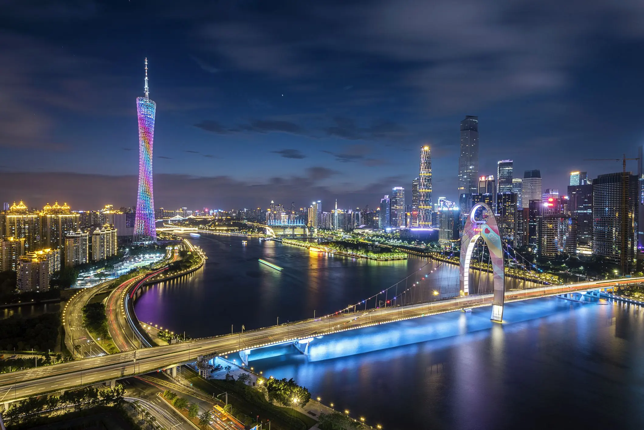


- Major national hubs: Beijing, Shanghai, Guangzhou, and Shenzhen are major centres for finance, technology, trade, government, and international business.
- Strong regional hubs: Chengdu, Hangzhou, Nanjing, Wuhan, Xi’an, and Suzhou have strong economies and modern infrastructure. Their technology sectors are also growing.
- Regional centres: Cities such as Zhengzhou, Shijiazhuang, Changsha, and Harbin serve important regional markets and industries.
- Smaller cities: Cities such as Jining, Yancheng, and Linyi generally play a more local or regional economic role.
Economic development also affects housing and everyday expenses.
How Do Living Costs Compare Across China’s City Tiers?
Living costs generally rise with housing demand and economic activity.
| City group | Examples | General living-cost level |
|---|---|---|
| Major national hubs | Beijing, Shanghai, Guangzhou, Shenzhen | Higher |
| Strong regional hubs | Chengdu, Hangzhou, Nanjing, Wuhan, Suzhou | Moderate to high |
| Regional centres | Zhengzhou, Shijiazhuang, Changsha, Harbin | Moderate |
| Smaller cities | Jining, Yancheng, Linyi | Generally lower |
Housing usually creates the biggest difference. See our cost of living in China guide for international students for detailed rent, food, transport, utilities, and student budgets.
Exploring China’s Economic Hubs: Key Drivers of Growth
Beijing-Tianjin-Hebei
Beijing-Tianjin-Hebei is a major economic region in North China. It includes Beijing, Tianjin, and Hebei.
In 2025, Beijing, Tianjin, and Hebei had a combined GDP of about CNY 11.99 trillion. This was roughly 8.6% of China’s GDP.
- Economic Hub:
- Beijing is the national political and cultural centre and the seat of the central government. Tianjin has major industries, while Hebei supports manufacturing and high-tech industries.
- Transportation and connectivity:
- Beijing has major airports, Tianjin has a large seaport, and Hebei has extensive road and rail links.
- The Beijing-Tianjin High-Speed Railway connects Beijing and Tianjin in under 30 minutes, supporting regional travel and business.
- Education and research:
- Beijing is home to leading universities such as Tsinghua University and Peking University. Tianjin and Hebei also have strong universities and research institutions.
- Tech and Innovation:
- Beijing, as a major tech hub, fosters startups and hosts global giants in tech and innovation, such as Baidu, Alibaba, and Xiaomi.
- Tianjin and Hebei also support high-tech manufacturing and regional industry.
- Environmental Efforts:
- Beijing has introduced policies to reduce PM2.5 air pollution. PM2.5 levels fell by about 23% between 2013 and 2020.
- Hebei has a large heavy-industry sector. The province has also promoted cleaner energy and green manufacturing practices.
- The region has expanded green buildings, electric vehicle infrastructure, and renewable energy sources as part of its environmental development.
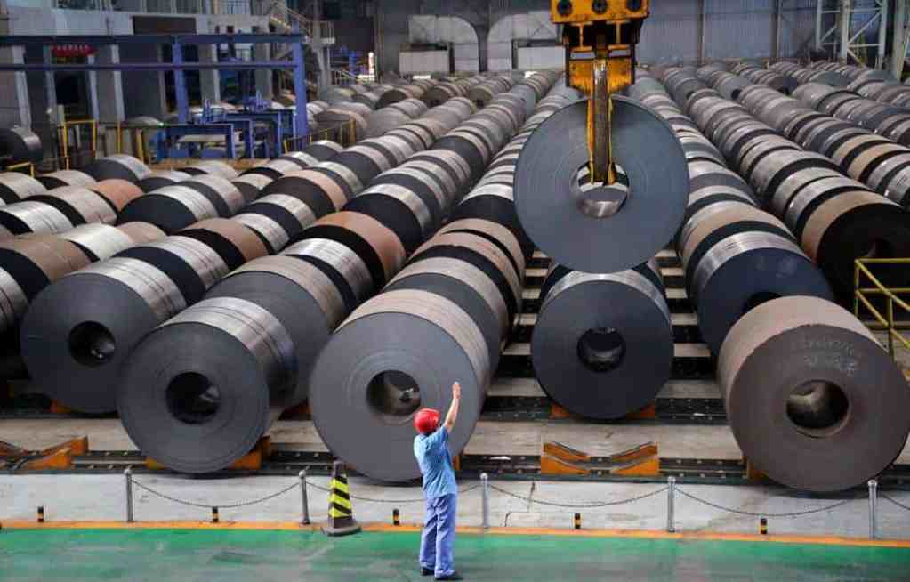
The Yangtze River Delta
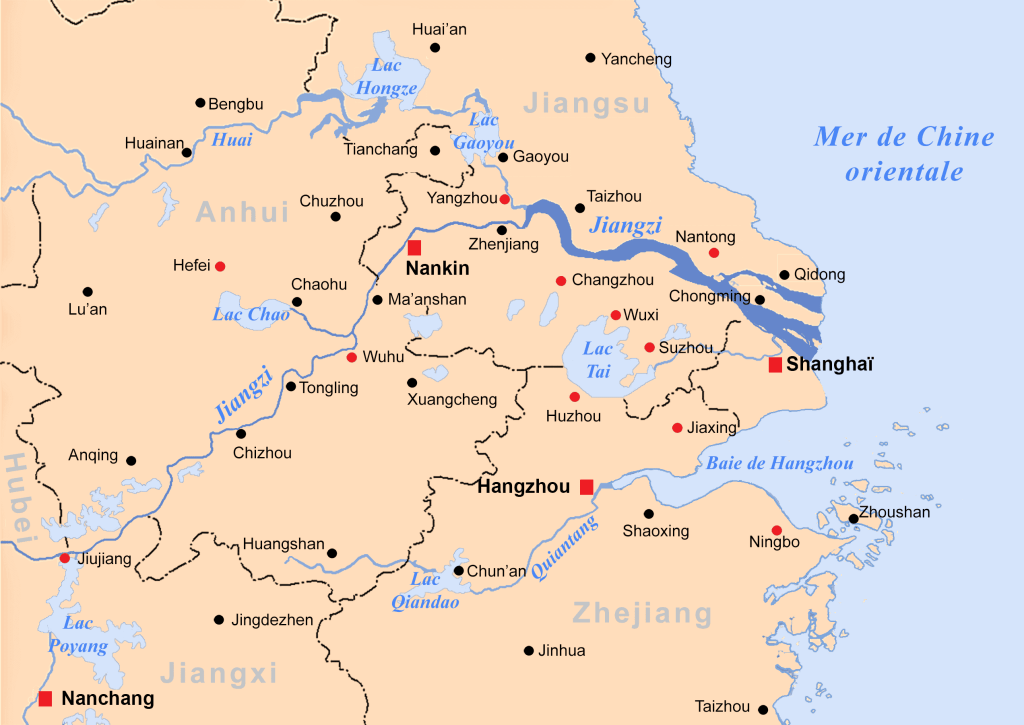
The Yangtze River Delta includes Shanghai and nearby cities. It is a major economic region and global trade hub.
The region has strong high-tech manufacturing, e-commerce, and finance sectors. Hangzhou is also a major digital-economy hub and home to Alibaba.
High-speed rail and expressways connect cities across the Yangtze River Delta. These links support trade, business, and regional growth.
The Yangtze River Delta Integration Plan supports regional development, green technology, trade, and economic growth.
The Pearl River Delta
The Pearl River Delta is a major economic region in South China. Key cities include Guangzhou, Shenzhen, Dongguan, and Zhuhai.
Its dense population, waterways, and industrial base make it important to China’s economy.
The region is a major centre for trade, manufacturing, technology, and finance.
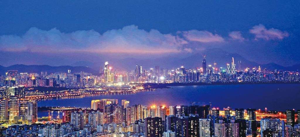
Its dense population, waterways, and industrial base make it important to China’s economy
- Guangzhou is a major financial and commercial centre. The Guangzhou Development District also supports fintech and international financial services.
- Dongguan as the “World’s Factory” specializing in electronics, textiles, toys, and household goods. Its manufacturing capacity and industrial output have contributed massively to China’s export economy.
The Guangdong-Hong Kong-Macau Greater Bay Area
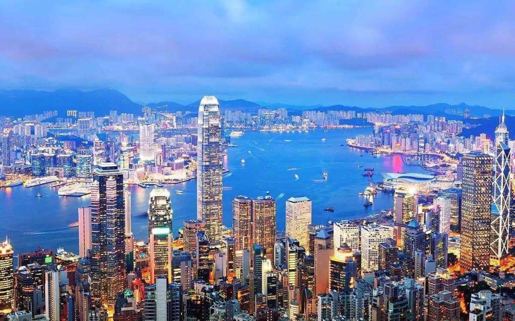
The Guangdong-Hong Kong-Macau Greater Bay Area links Hong Kong, Macau, and major Guangdong cities such as Guangzhou and Shenzhen.
Hong Kong and Macau are special administrative regions of China.
The delta covers less than 0.6% of China’s land but contributes nearly one-ninth of its economic output.
Key Cities:
- Shenzhen is one of China’s major technology and innovation hubs. It is home to companies such as Tencent, Huawei, and DJI, with strengths in AI, robotics, and biotechnology.
- Guangzhou serves as a major center for commerce, trade, and manufacturing, with a focus on automotive, electronics, and machinery. Additionally, Its proximity to Hong Kong strengthens its role as a key link in international supply chains.
- Hong Kong is a global financial centre. Its finance, legal services, logistics, and infrastructure support the Greater Bay Area.
- Macau is a major tourism destination with casinos and resorts. Its entertainment and hospitality industries contribute to the Greater Bay Area economy.
Zhuhai is growing as a high-tech hub for biotechnology, clean energy, and manufacturing. Its location also helps connect Macau with industries in mainland China.
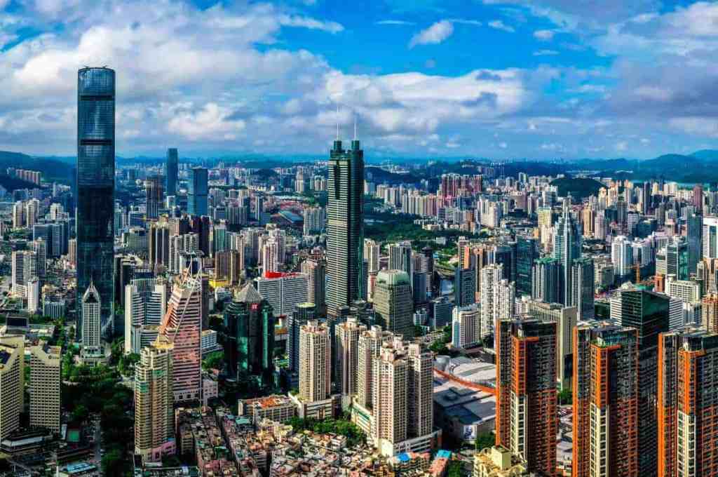
The Greater Bay Area is often compared with other major bay economies, including the San Francisco Bay Area and Tokyo Bay.
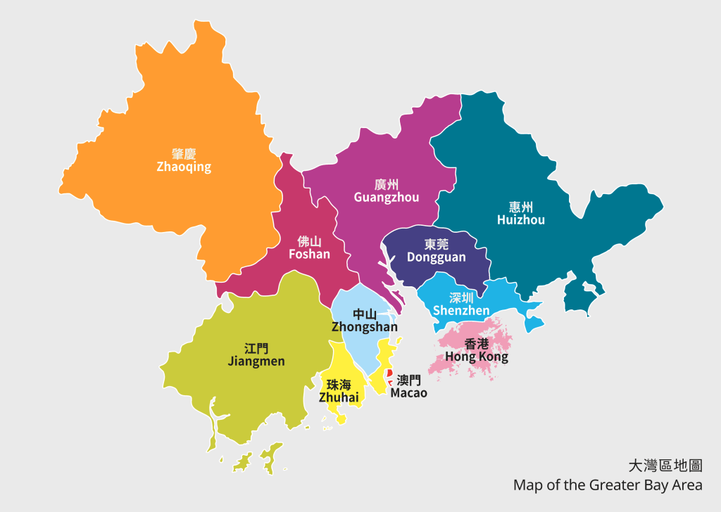
Comparison of Pearl River Delta and Greater Bay Area
| Aspect | Pearl River Delta | Greater Bay Area (GBA) |
| Scope | Includes cities like Guangzhou, Shenzhen, Zhuhai | Includes PRD, Hong Kong, and Macau with cross-border integration |
| Economic Power | Hub for manufacturing, trade, and exports | Focus on finance, tech, and innovation |
| Global Standing | Regional importance | Competes globally, on par with Tokyo Bay |
| Key Features | Industrial and trade-focused | Modern, integrated with global economic influence |
China’s mountains, plains, rivers, and coastal regions influence where people live and where industries develop.
Understanding China geography can also help students compare climates, transport links, universities, and economic regions.
Rapid city growth, technology, and infrastructure continue to shape China’s economic development.
For students focused on careers, economically developed regions can offer more job opportunities and industry connections.
We also help students compare cities based on universities, local industries, and long-term career goals.
Also, we guide students to locations with better job markets and growth opportunities, empowering them to build successful careers.
Finally, you’re done exploring China geography, your dream city in China is just within reach. Ready to make it a reality? Apply now with ApplyForChina!